Showing posts with label Toth. Show all posts

Monday, April 21, 2025

The Brown Family, The Monongahela, and The Two Alicias

The family homestead of William Hughey Brown, 1815-1875 (his Find A Grave Memorial), was situated along the Monongahela River, about five miles east of downtown Pittsburgh. William Hughey and his sons were coal operators. In particular, they pioneered shipping of coal by barge along the Pittsburgh rivers, and soon expanded their business down along the Ohio and the Mississippi. An 1889 posthumous biographical sketch of William tries to counter the impression that the Brown family wealth was acquired through government contracts during the Civil War, arguing that William was already prosperous before the war. Still it seems that business during the Civil War must have been as profitable as it was exciting and dangerous.

Several years ago someone compiled a comprehensively illustrated ebook genealogical history of the W. H. Brown family. That ebook at times could be accessed publicly online, but I don't know where it may be found now. You can follow the descendants of William Hughey Brown through the links from his Find A Grave Memorial to memorials for family members. You can do the same from his WikiTree Profile (currently only a few generations there) or from his profile at Family Search. (The latter link requires a free account registration and login. Also note that at FamilySearch William Hughey has been recorded as William Henry.) The links to individuals below are to their Find A Grave memorials.

This post is the first of what eventually will be a series of posts here, with the common thread being that there is some connection, even if tenuous, between the story of the Browns and the story of my family tree. Several of the threads deserve their own posts. This page is an introduction, with many details to be filled in later.

When William Hughey Brown died in 1875, there were four surviving sons. The oldest was Samuel Smith Brown, 1842-1905, (Samuel S.) and the youngest was William Harry Brown, 1856-1921, (W. Harry). One of the middle sons died in 1882, and then Samuel and Harry bought out the other middle son, leaving Samuel S. and W. Harry in charge of the family enterprises.

Brownsville, where I grew up, is also situated on the Monongahela, about 30 miles in a straight line south of downtown Pittsburgh, but about 55 miles upstream following the curving river. There is no evidence that the William Hughey Brown family was related in any way to the Browns who founded Brownsville in 1785. But it might be imagined that as attention turned to coal resources along the upstream Monongahela, the Pittsburgh Browns would be intrigued by a community named Brownsville. Sometime before Samuel died, he and Harry acquired coal property just southwest of Brownsville. Somewhat unusually for coal operators, the Browns' acquisition included much of the surface property several hundred feet above the coal beds. Today a big chunk of that surface property is the 467 acre Patsy Hillman Park.

Shortly after Samuel died, W. Harry Brown developed the coal part of their property near Brownsville, naming the mine Alicia, presumably after his daughter Mary Alice. About 10 years later Harry developed a second Alicia mine, about 12 miles farther south. The ebook genealogical history describes how Harry at his office in Pittsburgh closely supervised the architectural and engineering details of the two Alicias. A few years before Harry died, he sold his business interests to Pittsburgh Steel Company, which at its Monessen mill was already Harry's main customer. By 1936 the original Alicia was mined out. The surface properties there passed to the Hillman family. Probably not coincidentally, beginning in 1936 John Hartwell Hillman Jr. is listed among the members of Pittsburgh Steel's board of directors. In 1954 the Hillman Family Foundation presented to Brownsville much of the Brown->Hillman surface property, to be used as a community park. For several decades it was known as the Brownsville-Luzerne Community Park, but it is now Patsy Hillman Park. Below is a telephoto view taken almost 50 years ago looking northeast from the flagpole hill near the center of the park.

On the right side of this view is a water reservoir for Brownsville. Toward the left, on the far side of the Monongahela, is Krepps Knob, at 1350 feet one of the highest hilltops in the vicinity. Looking back toward the reservoir, heading on a straight line past the left side of the reservoir then down a steep hill on the other side would bring you to 770 feet at the river's edge. There you would be among the Bridgeport Patch houses, where my Hungarian grandparents raised their family. Back up at 1100 feet, visible on the left is a relatively flat area that is today's park soccer fields. Beyond the right side of this view there were other ameneties (e.g, golf driving range, kiddieland carnival rides) that came and went in the first decade or so of the park.

Let's go back to Samuel S. Brown. If you look at his Wikipedia page, you'll see there are only two sentences about the family coal business. Samuel was much better known nationally as an owner of racehorses, and a promoter of interest in that sport. His New York Times obituary (link is on the wikipedia page) reports that, His stables and stock farms were at Brownsville, Penn., and Lexington, Ky. In 1904 J. Percy Hart published Hart's History and Directory of the Three Towns (Brownsville, Bridgeport, West Brownsville). Hart's History has a biographical sketch for Samuel, as well as a separate portrait of Samuel with a caption. Much of Hart's sketch is taken from a sketch that had appeared in a Pitsburgh paper earlier in 1904, and both sketches dwell mostly on Samuel's racing interests. Hart's 1904 caption for the portrait reads, Capt. Samuel S. Brown, Who Owns A Stock Farm Just Above Bridgeport--the Home of "Troubadour." The Area of this Farm is 999 1/2 Acres, Underlaid with Coal. It took me awhile to connect the dots--obviously Just Above Bridgeport is today's community park. So as a child, when approaching The Park what I was feeling must have been the spirit of old Troubadour grazing in the grass-covered hills.

Tuesday, March 21, 2023

More 1930 Slovakia Census, An Index for Two Hungarian Villages

As mentioned at the beginning of the previous post, I've been reviewing the 1930 census sheets from my grandfather's home village of Nagy Szelmenc and the adjacent village Kis Szelmenc (Czech/Slovak Veľké and Malé Slemence). I've now completed an index of selected information from those census sheets. More about that farther down in this post. But first, in the next few paragraphs, I'd like to restate a few main points from that previous post, maybe more clearly this time.

In that previous post the main main point is the embedded image, which is a map from a 1921 history of Czechoslovakia. The map displays the eastern half of the Czechoslovakia that existed before World War II. The image title states, in Czech/Slovak, that the map is of Slovakia (Slovensko) and of Subcarpathian Rus' (Podkarpatská Rus). A solid bold line encompasses the two areas; together they were the eastern part of pre-WWII Czechoslovakia. A dashed bold line divides the two areas. (The breaks are very short; takes awhile to recognize it as a dashed line.) The figure, from wikimedia commons, is repeated below.

On the map the county of Užhorod is labeled in all caps. A much smaller label, in upper and lower case, marks the city of Užhorod. The dashed line follows a tight nearly three-quarter circle around the city. The western border of today's Transcarpathia lies a few to several miles west of this 1921 wavy dashed line. Transcarpathia extends slightly farther west than the interwar Podkarpatská Rus; they are not the same thing. Equivalently, the Slovakia part of pre-WWII Czechoslovakia extended several miles farther east than today's Slovakia. About this interwar dividing line—when was it first established as the western boundary of an intended semi-autonomous Ruthenian region, which country did that, and what were they thinking, why the waviness? That is a story for another time.

The final main point is that before WWII Czechoslovakia conducted two censuses of the country, one in 1921 and the second in 1930. For each of the two areas on this map, the process of restoring, digitizing and making the census images available online has so far been conducted for only one of the census years. For Podkarpatská Rus it is the 1921 census that is available online; the 1930 census is not available. Conversely for pre-WWII Slovakia it is the 1930 census that is available online; 1921 is not available.

Now back to my index of the two Szelemenc/Slemence villages in 1930. I've placed the index on google drive in three formats: (1) the Numbers file from my Mac laptop; (2) an xlsx file exported from Numbers; and (3) a CSV file exported from Numbers. Although the columns of the index are mostly self-explanatory, some additional explanation may help. Along with the explanations will be hints and lessons learned from working with this 1930 Slovakia census.

In the first column, Sheet, the leading number 317 was assigned by the archives to the box in which those sheets had been stored. The number after the slash was assigned to that sheet when the restoration process began. A small, white, scanable and human-readable label was attached near the top right corner of each sheet, and is visible in the online images. These box/sheet numbers are a modern creation, unknown in 1930. The box/sheet number can be used in the search field at the Slovakiana site. To aid the search results, occasionally it may be necessary to add a comma, a space and the first letter of the village's Slovak name (in this case M or V) in the search field. For example "317/92, V", without the quotes. The front of a sheet holds information for up to nine persons; if all nine rows are filled, click the right arrow to check if there are more persons on the back of the sheet. The House Number is as recorded by the enumerator. I don't know if these numbers were pre-assigned on a map, or if the enumerator simply entered a number in order of visitation. Kis Szelmenc (Malé Slemence) had its own set of house numbers, 1-59, which appear in reverse numerical order when viewed by Sheet order 317/1-59. Nagy Szelmenc (Veľké Slemence) was a bigger village, spanning sheets 317/60-248. Nagy Sz. has two sets of house numbers 1 through 28. The second set 1-28 was recorded for the Roma (gypsy, Hungarian cigány) neighborhood(s). What I call Head is the person on the first line of the census sheet, even though sometimes the situation was more complicated. The religion columns will be discussed in later paragraphs. Online the Slovakiana site also has summary sheets from 1930. The numbers in the last column of my index indicate that the summary sheets for this area had been stored in box 1201. (Subtotal summaries for other villages in the area include: Palad' 1201/28-29, Ptruska 1201/32-33, Ruská 1201/34-36, Vajany 1201/41-42, etc.) The information on these summary sheets is roughly the second, third, fourth, sixth and seventh columns of my index. The summary sheets also contain hand calculations of subtotals and grand totals. It appears that these summary sheets must have been folded into four-page booklets. When unfolded, the first and last pages appear on the first scanned page; click the right arrow to view the inside pages. The population total in 1930 for Malé Slemence was 303 and for Veľké Slemence it was 892. My great-grandfather is on sheet 317/61.

The 1930 Czechoslovakia census forms included columns for nationality and for religious affiliation. The vast majority of individuals in the Szelmenc'es were recorded as Hungarian. I've noted the rare instances when someone was recorded as Slovak or Czechoslovak. I've also noted when the nationality was recorded as cigány. There are two clusters of these, sheets 317/151-165 and then sheets 317/184-196. Everyone in these clusters was recorded as cigány. Conversely, no one outside of these clusters was recorded as cigány. For all those with Jewish religious affiliation, recorded either with the older Hungarian term izraelita by enumerator II or with the term zsidó by enumerator I, their nationality was recorded as zsidó (thus that entry in the notes column would be redundant). I suspect that many of the Roma and Jews would have thought of their nationality foremost as Hungarian, having ancestors who lived for centuries in the Hungarian part of Austria/Austria-Hungary, but had no choice how they were recorded.

Long before the 1930 census became available, I perused the information in the 1877 Dvorszák Gazetter, images available online from the University of Pécs. See this 2012 blog post, Boundaries of some Greek-Catholic Parishes in Old Hungary as well as my grandfather's wikitree page. For each village the 1877 Gazeteer provides population totals broken down by religious affiliation. Here are the 1877 numbers for Nagy Szelmenc (p. 738): Greek Catholic 314; Roman Catholic 175; Reformed 200; Jewish 69. Adding, the total population in 1877 was 758, slightly less than 1930's 892. The breakdown in 1930, from my index: Greek Catholic 385; Roman Catholic 268; Reformed 208; Jewish 30; Unstated 1. It's interesting to notice that in 1930 nearly 100 households subscribed to multiple Christian denominations. (For example, if the 1920 US census had recorded religious affiliation by baptism, my Dad's childhood family would have been 4 GC, 1 RC.)

I often explain to people that Toth is a very common Hungarian surname (and that Hungarian o, with or without an accent mark, is always pronounced like the o in both). The commonness holds true within the two 1930 Szelmenc villages, where 24 households were headed by a Toth.

Thursday, November 3, 2022

Subcarpathian Rus'--Loose Mentions and Misunderstandings

This post is a follow-on to my reviewing of the 1930 census sheets from my grandfather's home village of Nagy Szelmenc and the adjacent village Kis Szelmenc (Czech/Slovak Veľké and Malé Slemence). About two years ago the 1930 census became available online, following a 90-year privacy period.1 I was slow to realize that the information was available, but have now updated several WikiTree pages, including those for my grandfather's brothers and their father, and for my grandmother's sister in Csap. I'll have more to say about that 1930 census itself, including lessons learned, in a later post.

Intending to summarize some of the information, but also wanting to avoid reinventing the wheel, I searched for what other people have been doing with this 1930 census. In the process, which has included following links to descriptions of the history of the area, I've found that many play fast and loose with terms they use to label broad and narrow regions, glossing over context and time, substituting alternatives as if they were equivalent synonyms from a thesaurus. There is a lot of history, with many labels. But my concern for this post is about the early censuses from Czechoslovakia, and thus is limited to two time periods. The first period is 1921-1930, when the censuses were conducted. The second period is now and recent decades, when the information has been made available.

I found this map at wikimedia commons.

The map is from a 1921 history of Czechoslovakia. The broken line boundary through the county of Užhorod separates two parts of Czechoslovakia. On the west is the Slovakia (Slovensko) part. On the east is the Subcarpathian Rus' (Podkarpatská Rus) part. Notable on the map around the city of Užhorod is how the boundary forms a tight nearly three-quarter circle around the city. The term Subcarpathian Rus' has been reasonably applied by many people to a broader area based on their analyses of earlier reported ethnicities. But for the purpose of discussing the census records, it is the area as shown on this map, which was defined in the establishing treaties and founding documents for Czechoslovakia. As I understand, within Podkarpatská Rus there were numerous internal rearrangements of county and district boundaries between 1921 and 1930, but the western boundary of Podkarpatská Rus remained the same in 1930 as it had been in 1921.

Then there is the border today, which has not changed since 1945. When Stalin annexed Transcarpathia to the Ukrainian part of the Soviet Union, the border line was straightened and moved comfortably west of the city of Užhorod. Transcarpathia is slightly larger than Podkarpatská Rus; they are not the same area. Podkarpatská Rus is not Czech for Transcarpathia. According to Google Translate: Czech for Transcarpathia is Zakarpatí; Slovak for Transcarpathis is Zakarpatsko.

It is the position of the Slovak National Archives that census sheets from 1930 stored by them are only from present-day Slovakia.1 Yet it is clear that the 1930 census sheets made available online by the Slovak National Education Center at their Slovakiana site include all of Slovensko as it was in 1930, which includes the far western part of today's Transcarpathia. The Slovakiana site does not include Podkarpatská Rus.1

I don't know if the census sheets for Podkarpatská Rus were at some point transferred from Czechoslovakia to Transcarpathia, or if the Podkarpatská Rus sheets were always stored there and remained there as part of Transcarpathia. At any rate, in 2017 the Budapest Capital Archives went to the Beregszász (Berehove) section of the Transcarpathian State Archives and digitized the 1921 census sheets for Podkarpastká Rus. The digitized sheets are available online. That online collection is not a 1921 census for Transcarpathia. It is the 1921 census for Podkarpatská Rus.

Reference 1. Email responses from the Slovak National Archives archiv.sna@minv.sk and the Slovak National Education Center slovakiana@nocka.sk to questions from Jim Toth, October 2022.

Tuesday, May 17, 2022

My Grandparents' European Neighborhood

On my mother's side of the family tree there are paper trails going back five generations. And over the last few decades I've visited several of those maternal ancestral locations, both in the United States and in Ireland. My father's side is in some ways simpler, but in many ways much more complex. This post will be about where my paternal grandparents came from.

On that paternal side I am only two generations removed from Europe. When my grandparents left in 1905, each only age 15, their native region was then far from any international border. Today that area is the meeting point of three countries: Ukraine, Slovakia and Hungary. Eight years ago I traveled to Hungary and approached the old neighborhood, getting close to the border but staying on the Hungary side. Since then I had an urge to get closer, but did not feel comfortable about traveling in Ukraine on my own, especially to the rural villages. I eventually signed up for a tour of Ukraine. The tour operator offered an add-on, which I took advantage of. After the regular tour ended in Lviv in late October, a driver and the tour guide took me southwest to Uzhhorod in Transcarpathia, and from there to my grandparents' villages.

About five months ago, in the previous post here, I focused on the topography of the Carpathian Mountains, zooming in on the rural area which the regular tour had visited. When writing that previous post I had been intending that for this post at this point I would simply share recent pictures from western Transcarpathia. But in the meantime Russia began attacking Ukraine. We've been reminded that the four countries bordering Transcarpathia are all members of NATO. Autocratic leaders in Russia and in Hungary have amplified their nationalistic xenophobic propaganda to justify and maintain their corrupt holds on power. So it now seems impossible to show recent pictures without dwelling a bit on the history and politics of the area. I'll do the travelogue and the ruminating together, intermingled, beginning by going back to the previous post.

I'm kind of proud of how the first figure in that previous post, the unzoomed-in version, displays the broad arc of the Carpathians while at the same time highlighting small-scale drainage features. You might want to click on that image in the previous post and keep the image open in a separate window. From now on I'll call that image "the topo map." The area of the topo map was mostly beyond the influence of the Roman Empire, even at its greatest extent. As Christianity expanded, missionaries entered the area. Over several centuries they obtained mixed and limited results. Ultimately, over a period of only three decades ending in the year 1000, the Pope and his counterpart in Constantinople made individual deals with each of the rulers of three kingdoms. Each of the three kingdoms extended beyond the topo map to broader areas: Poland to the northwest, Russia to the northeast, and Hungary to the southwest. Thus the topo map is comprised of what were fringe territories of the three newly recognized kingdoms. The kingdom of Russia was headquartered at Kyiv; Moscow was then just a backwoods trading post, and remained that way for another 500 years. The part of today's Ukraine that is on the topo map (excluding Transcarpathia) first came under the yoke of Moscow's tyranny in September 1939 (see for example Timothy Snyder's Bloodlands).

As I've gotten into genealogy and DNA testing for genealogy, I realize more and more that there is a difference between ethnicity and ancestry composition. My grandparents and their relatives and friends who immigrated to America over a hundred years ago were very much ethnic Hungarian. They had grown up in the southwest part of the area that today is Ukraine's Transcarpathia. But from 1867 until the end of World War I the area that is today's Transcarpathia was in the Hungarian part of Austria-Hungary. In 1867 Austria had turned the clock back to the year 1000 by granting a great deal of autonomy to a partially restored Kingdom of Hungary. The Hungarian part of Austria-Hungary covered all of Sub-Carpathia (the inside of the arc of the Carpathians) including not just today's Transcarpathia but today's Slovakia and the northwest part of today's Romania. Enlightened Hungarian leaders of the 1870's recognized that their Kingdom was multi-ethnic and multi-cultural, and required respect for everyone. But by the time my grandparents were born, a policy of Magyarization (Hungarianization) had taken hold.

Tensions were already rising before 1918, and after 1918 many things happened in the area that is today's Transcarpathia. My grandparents never went back after 1905. A few old papers remain, financial and vital records, that document international mail exchanges into the 1920's. But after that decade contact was lost between my grandparents and the old country.

In today's Uzhhorod I saw no evidence of accomodating two languages. But in the villages closer to the border with Hungary it's clear that to this day many consider themselves ethnic Hungarian. It was fun to pretend to be trilingual, at least for the purpose of reading the place names and "Welcome To Our Community."

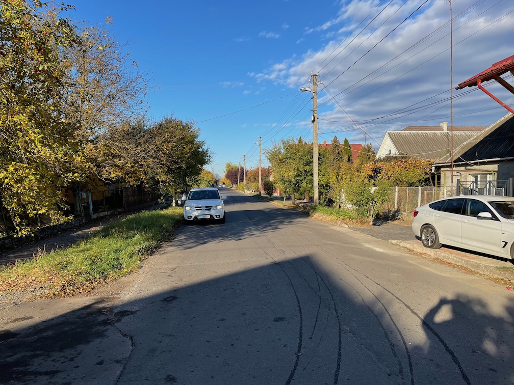
My grandmother was born in Chop (Чoп, Csap), and her mother was born across the river in Zahony. Eight years ago on the rental agreement I specified that I would not take the car out of Hungary. My plan had been that after parking the car in Zahony, Hungary, I would take the very short local train ride across the river and then from the train station walk the old main street of Csap. But the ticket agent at the Zahony station said that nothing was available until three days later, and I had plans to be across the country by then. This past October I finally made it to Csap. Below are views looking both directions along the street from near the corner where I think my grandmother's family lived.

It was a very quiet fall Saturday morning. The JewishGen page for Chop has map links, a historical summary and many old and new photos, including some of the Roman Catholic church which my grandmother would have attended. The current church is dated 1903 by the inscription above the main entrance. The morning sun gave a glare to the picture there; I like this one better from the side. I'm standing on the grounds of a very large building that is labeled community center, but looks like it could have once been a school.

Szürte is situated about halfway between my grandmother's Csap and my grandfather's Szelmenc. My grandfather's mother was Barbara Meszaros; we don't know anything else about her, presumably from Szürte like the other Meszaros's. Except for getting out for the picture earlier above with the west side entrance sign, my other pictures of Szürte were taken through the window of the car. I'll leave detailing Szürte itself to my Meszaros cousins.

Szürte is near the north-south main highway connecting Uzhhorod with the border crossing at Csap/Zahony. As in Csap, the buildings in Szürte appear from the outside to be well maintained. But that gets left behind when heading to my grandfather's area. Getting there requires traveling west from Szürte, and very quickly you are in the middle of nowhere. In the two pictures below, especially the first one, the Carpathian mountains can be seen on the distant horizon.

Some potholes were so large that if Russia were to bomb the road it would be hard to tell. Speaking of Moscow, visible in the second photo are the remains of a collective farm, out in the middle of nowhere. Previously the tour guide had pointed out other such remnants, but they were close to main roads, with houses around. I knew that when the Soviet Union took control of Transcarpathia after World War II resistance had been violently suppressed. For example, Greek Catholic priests had been murdered. Still it was disturbing, and remains so, to see physical remnants of that time so close to locales on my family tree. I can even see what looks like a guard tower at a prison. It's reminders like that that have Ukrainians determined to recover their territory currently occupied by Russia. The Ukrainians concern is about more than just which accent or dictionary will prevail.

The name Szelmenc is not derived from Hungarian. Instead, according to the town history a Polish Count received a grant of land from the Pope in the 1300's. The Count's name as it was converted into Hungarian became Szelmenc. (In Hungarian, the combination sz is pronounced s; an s without a z is pronounced sh. The c at the end gets a ts sound). As often happened with other villages in Hungary, over time the Count's property was developed into two adjacent settlements: Little Szelmenc and Big Szelmenc, in Hungarian Kis- and Nagy-. My grandfather's birthplace was Nagy Szelmenc, which is Veľké Slemence in today's Slovakia. Big and Little have experienced a complicated national history, together before 1945 and separate since. Between the two World Wars what is now known as Transcarpathia was a part of, an eastern extension of Czechoslovakia. With Hitler's blessing in November 1938 Hungary annexed about 15% each of today's Slovakia and today's Transcarpathia (see for example Paul Lendvai's The Hungarians). All of the annexed territory, which included both Szelmenc's, had been part of Czechoslovakia since 1919. In March 1939 Hungary annexed the other 85% of today's Transcarpathia, despite the fact that the population of that 85% area had always been predominately non-Hungarian. After World War II Hungary's border was reset to where it had been established after World War I. The Soviet Union annexed Transcarpathia, creating a new eastern border for Czechoslovakia. The new border started out from Hungary extending north-northeast. Most towns fell easily east or west of the straight line, but at Szelmenc there was a problem. A slight dogleg was inserted into the straight line to put all of Little Szelmenc in the Soviet Union and all of Big Szelmenc in Czechoslovakia. Almost 20 years ago a border crossing for pedestrians only was established between the two Szelmenc's. I could not cross there with just my USA passport. I knew that, but had thought that I would be able to see across the border. Unfortunately buildings and other structures have grown to block the view. I was told that without crossing papers I could not pass the limits of Little Szelmenc, marked by the sign in the first photo below. The entire roof of the building on my right was in even worse shape than the corner. The building behind it, with the blue wall, was signed near the top, in English, Shopping Center. In the background of the second image you can see Ukraine, and then Slovak Republic (Slovakia). Someday I'll visit Slovakia, entering with my USA passport, and then find someone to escort me to the border on the other side.

So back to there being a difference between ethnicity and ancestry composition. The genealogical DNA test companies all provide percentage "ethnicity" estimates. For example, my autosomal DNA yields estimates of roughly 47% Irish and 45% Eastern Europe, with leftover percentages for Scotland, the Baltics and about 5% Mediterranean (the specific areas bounce around from the Adriatic to Spain to The Levant). Some companies properly avoid the term ethnicity. For example 23andMe substitutes a bland but more suitable "ancestry composition." Usually when a DNA match is selected you can also see the match's "ethnicity" estimate, the reasoning being that the common ancestor must be in one of the overlapping "components." For my matches where the overlapping component is Eastern Europe, those who specify known ancestors from there are more likely to specify Ukraine, Poland or Slovakia as their ancestral location rather than Hungary. For my grandfather I specify Hungary because, I say, "That is what it was when he left there." It's no more than ethnicity. My YDNA tells an interesting story about ancestry composition. But, aside from a link to this project page, I'll save discussing YDNA for a future post.

Sunday, December 5, 2021

Carpathian Topography

Ever since days as a Boy Scout I've collected topographic maps. Each new place has meant getting oriented to the lay of the land. These days satisfying that topographic itch is less about paper maps and more about digital data. I rely on elevation data downloaded several years ago from the GLOBE project.*

As I've gotten into genealogy it's also been interesting to examine the lay of the land for places where my ancestors migrated from. The places they left in Europe are mostly flat, agricultural lands. I already knew that was the case for the immediate vicinity of the hometowns of my Hungarian grandparents. Nevertheless on good days from their small towns my grandparents would have been seeing the Carpathian Mountains on the northeast horizon.

Checking online for information about the Carpathians, I found this site, which includes a large scale topographic map presenting the Carpathians extending in an arc from northwestern Slovakia to southern Romania. I also found this site, with a topographic map restricted to the Ukrainian Carpathians. On both of those maps the contour and/or shading interval does not do justice to small features. (Additionally an annoying aspect of the Ukrainian Carpathians site is that names on the map are in Russian instead of Ukrainian.) The alternative map below similarly covers the Ukrainian Carpathians, also extending into parts of bordering countries.

Those bordering countries are: Hungary in the southwest corner; Romania east of Hungary and south of Ukraine; in the northwest corner Poland; and Slovakia between Poland and Hungary. The western letter C marks the location of my grandmother's hometown, Chop (Hungarian Csap), on the Ukraine-Hungary border. My grandfather's hometown is a short distance to the northwest, on the Slovakia-Ukraine border. I've also marked in that western part of Ukraine's Transcarpathia the locations of the cities Uzhhorod and Mukachevo.

In later multiple posts I'll return to western Transcarpathia. But in this post I'll focus on a portion of the group tour conducted by Cobblestone Freeway. Stops included Chernivtsi (the letter C on the eastern edge of the map above), the village of Tulova (T), Kosiv (K) and the mountain areas near it, and Lviv (L, on the northern edge of the map above). I-F is Ivano-Frankivsk, capital of its province. Below is a view zoomed in on the mountains near Kosiv.

Besides being the site of Ukraine's highest point, additional top-10 peaks are located in the Chornohora Range, which as the maps show forms part of the border between the provinces of Ivano-Frankivsk and Transcarpathia. The highest peaks slightly exceed 2000 m. But the GLOBE data are averaged over approximately 1 km2, so the highest pixels (the darkest reds) displayed here are just over 1900 m. It's my understanding that the traditional Hutsul region extends west to that range, and wraps around it into extreme eastern Transcarpathia. But the tourist attractions, and the attention of the Cobblestone tour, are in the area closer to Kosiv, where the mountain ridges rise to just a bit above 1000 m (comparable to the Allegheny Mountains of central Pennsylvania). On the map above the letter S marks the location of the tour hotel. Each day's excursion began by heading northeast, descending along the valley until clearing the last big ridge. Then a left turn to the northwest, on a relatively straight and level road to Kosiv. Later excursions continued upstream from Kosiv to the pass at Bukovets (letter B), and from there down into the valley of the "Black" branch of the Cheremosh River, ultimately crossing that branch and then a short distance back uphill to the Museum of Hutsul Magic (HM on the map). It was only after returned from the trip and then independently researching the river that I appreciated that that branch, and other branches not visited, all drain into the valley overlooked by the tour hotel (S). Below is a view from the tour hotel looking northeast down the valley. The view is lit by the mid-October sun close to setting. The ridge on the left is the one needing to be cleared before making a left turn to Kosiv.

* For a discussion about the free software used to create the maps shown here, see this recent post in my other blog. Here's a python detail for reading a tile, which is GLOBE's terminology for one of its data files:
import numpy as np
fptopo = np.memmap('g10g', dtype='int16', mode='r', shape=(6000,10800))

Friday, February 7, 2020

Auschwitz

Each week The Economist magazine includes a one-page story headed Graphic detail. Accompanying the story is some innovative graphical presentation of a large volume of data. For example the current issue discusses how Ranked Choice Voting might play out if it were used in this year's Democratic primary. The featured graphic, based on results from a poll that asked voters to rank the candidates, shows how votes would flow from each eliminated candidate to next choices among the remaining candidates.

Last week the Graphic Detail subject was The Holocaust. The featured graphic in that issue is a map of Europe (extending to parts of the Mediterranean coasts of Africa and Asia) showing the number of Jews killed at Auschwitz by place of origin. Small hexagonal areas (I estimate the size of a hexagonal dot to be about 20-25 km diameter) are shaded to indicate the number from that small area. The darkest shading indicates a number exceeding 1,000. It's unsurprising that urban areas like Paris or Prague stand out as darker dots against a relatively light background. But what stands out even more is that certain rural areas are densely and extensively covered by dark dots.

What that has to do with genealogy is this. On the Auschwitz origins map a dense and extensive cluster of dark dots is centered on the area where my Hungarian grandparents left from in 1905. I was already aware that deportations to Auschwitz from that area took place rapidly in late Spring and early Summer of 1944. And we know from pre-1900 gazeteers that the population of that area had been about 10% Jewish, with the percentages not varying much from larger towns to smaller villages. But it is still striking to see the numbers presented graphically. My impression is that back around 1900 what was generally true for members of other denominations in that area was especially true for Jews in that area. They thought of themselves as Hungarians. Some of the Hungarian Jews deported to Auschwitz in 1944 could have rubbed shoulders with my Catholic grandparents pre-1905.

A few points about the graphics in The Economist story. In the online version of the story the map is followed by a bar chart, with the two graphics separated by a few paragraphs of text. In the printed version the bar chart is juxtaposed with the map. The numbers are different for the two graphics. The dark shadings in the bar chart are for all Jewish deaths during the Holocaust. The shaded dots on the map are for the subset of Jews killed at Auschwitz. There is an order of magnitude difference in the two numbers for Poland. For the country labels on the bar chart and for the country borders drawn on the map, the fine print explains that the countries are defined by their pre-1938 borders. The pre-1938 Poland extended much farther east than today's Poland. The pre-1938 Hungary was basically the same as today's Hungary. Lying between pre-1938 Poland and pre-1938 Hungary (borders for those two countries are highlighted on the Auschwitz origins map) is pre-1938 Czechoslovakia. The eastern extremity of pre-1938 Czechoslovakia took in the area that today is known as Transcarpathia, in Ukraine. In late 1938 Hitler awarded Hungary the southern part of Transcarpathia, and the following March Hungary annexed the rest of Transcarpathia. Bordering pre-1938 Hungary and pre-1938 Czechoslovakia on the map is pre-1938 Romania. In 1940 Hitler awarded northwest Romania (northern Transylvania) to Hungary. The cluster of dark dots in northeast pre-1938 Hungary extends into the neighboring pre-1938 countries of Czecholovakia and Romania, perfectly matching the borders of Hungary in 1944 (map on p. 362 of Paul Lendvai, The Hungarians, Hungary between the World Wars; Hungary's frontiers after the Treaty of Trianon, 1920; Territories regained, 1938-1941).

The argument made by Hungary to its ally, Hitler's Germany, for Hungary being awarded in 1938 and 1940 parts of neighboring countries was that living in those areas were significant numbers of Hungarians. which included a significant number of Hungarian Jews, who a few years later were deported to Auschwitz by Hungarian police.

Tuesday, April 30, 2019

Rijeka II

Two years ago I wrote my initial impressions of Rijeka from while on a Rick Steves Best of the Adriatic tour. The tour guide did a good job of pointing out the highlights of the city through the bus windows. But the bus did not stop, and things went by very quickly. I resolved to go back some day for a closer look, and did so recently.

The (morning) view above is from Trsat, from a point a few hundred feet southeast of the castle. Overall in Rijeka there is a long hill that closely parallels the Adriatic. But at this spot a river flows through a narrow canyon. As it approaches the Adriatic the river has been channelized, creating a bit of an estuary and harbor for smaller boats.

The evening view above, looking toward Trsat, seems not to have changed much in over 100 years. The main difference: these boats have motors; in 1904 they were using sails.

Just northwest of where the channel meets the Adriatic there are larger ships docked.

In the background left is the boat-hotel, where I had a pleasant stay. In the area between the boats, on Palm Sunday afternoon they were having some sort of celebration. Before the celebration ended, loudspeakers were blaring Bohemian Rhapsody up into the hillside. A few blocks up that hill is the Maritime and History Museum of the Croatian Littoral.

The museum has a central atrium, with galleries wrapped around on two floors. Some of the gallery rooms are furnished as they would have looked around 1900, when Rijeka [then known as Fiume; Rijeka = Fiume] was governed as a Hungarian city in Austria-Hungary, and today's museum building was then the governor's mansion. But most of the rooms in the museum are dedicated to special exhibits. One of the highlights on display is a life jacket from the Titanic. The display case holding the life jacket is flanked on either side by scale models, of the Titanic itself on the right, and of the much smaller Carpathia on the left.

The Carpathia in April 1912 picked up survivors from the Titanic and took them to New York. More significant for me is that my Hungarian grandmother had embarked from Rijeka on the Carpathia on 28 October 1905. I learned from the information in the exhibit that the Cunard Line had reached agreement with Hungary to transport emigrants from Rijeka starting in October 1903. After that every two weeks one of the ships from Cunard's fleet [15 ships made for Cunard from 1900 to 1914] set sail from Rijeka [stopping at ports in Italy] to America filled with people who emigrated from Italy, Croatia and Hungary. So when my grandmother chose (or had chosen for her by whoever paid for the trip) to travel from Rijeka in 1905, that route was a relatively new option. (My grandfather, traveling that same year with his experienced uncles, took the long-established route from northeast Hungary through Hamburg.) My grandmother's younger sister, Elizabeth, followed in December 1909, also traveling aboard the Carpathia, also sailing from Rijeka. (The Carpathia served the England-New York tourist trade during the summer, returning to the Mediterranean/Adriatic emigration service during the fall, winter and spring.) There is much more about the area's long sailing history on display in the museum.

The bus station is almost all parking lot, blessed by the facade of the Capuchin Church. There is a small ticket office near the corner on the right. Buses constantly arrive from and depart for the more touristy places in Croatia. Underrated Rijeka is well worth the bus trip.

Sunday, October 22, 2017

Rijeka

I signed up for a Rick Steves Best of the Adriatic tour partly because of historic connections with Hungary. On the tour I learned about, and tasted, even more such connections. The Rijeka connection still fascinates me.
I knew that we would be stopping for a few hours in the nearby resort town of Opatija, but not in Rijeka itself. So I was glad that the weather that day provided a good view across the bay of Rijeka's sprawl (as the RS guidebook puts it).
When my Hungarian grandmother, Mary Barkó, sailed from Rijeka [Fiume] 112 years ago this week, likely that city sprawled less in both the vertical and horizontal directions. Still, her last view of what was then the Austria-Hungary Dual Monarchy would have looked something like the background above.
I have read that Hungarians today sometimes bypass their own country's Lake Balaton, seeking water fun instead on islands in the Adriatic near Rijeka. But already in the early 1900's, some Hungarians were not traveling to the Adriatic to escape. Those who already had good fortune went just for fun. For example, the Hungarian author Dezső Kosztolányi in the early 1930's reminisced about his 1903 high-school-graduation-present trip to the Adriatic (Kornél Esti, trans. Bernard Adams, 2011, New Directions Books, ISBN 978-0-8112-1843-6). Part of the romance and excitement of anyone's trip to the Adriatic in those days would have been the train's descent from the ridges behind Rijeka.
Below is a view of Opatija itself, looking in the opposite direction from the view above.
The RS guidebook (p. 165) has this to say about a close-up view of Rijeka today:
Like Opatija, much of Rijeka's architecture is reminiscent of the glory days of the Hapsburgs. But unlike Opatija, most of Rijeka's buildings haven't been renovated, giving it a seedy, gritty, past-its-prime feel.
My close-up impression of Rijeka, seen only from inside the tour bus, was a glass half full. So I plan to go back some day for a closer look.

Sunday, June 19, 2016

My YDNA Cousins

I've taken all three kinds of DNA tests for genealogy (i.e, for the paternal branch, for the maternal branch, and for every branch of the family tree). For all three, I've been in contact with distant cousins, but for nearly all of those distant cousins we will never know exactly how we are related. Still, it is interesting to see the ancestral locations and imagine how those connections came to be.
For the paternal branch, YDNA, there are a variety of entry level tests, and then there are a variety of upgrade packages. About a year ago I upgraded to a super-deluxe YDNA level, a level which qualified my results to be analyzed at ytree.net. But since mine had already been analyzed at the Family Tree DNA U-152 site, it was only recently that I provided my results for additional analysis at the other site. Both sites agree with my position on the tree.
The ytree.net site has an interesting feature in that the ancestral locations can literally be seen, since individuals on the tree are displayed with a flag indicating their known ancestral nationality. For example, this small portion of the tree at ytree.net is the DF90 branch, which includes my result, which is displayed with a Hungarian flag, for my grandfather.
Considering both sites, there are a handful of results that are closest to my own, with one of them appearing only on the ytree.net site. That result is displayed there with what was initially an unfamiliar flag. From the Family Tree DNA U-152 site I already knew that the DF90 results available so far are widely dispersed across Europe, extending to Turkey and Algeria. Seeing the unfamiliar flag, I initially supposed that the flag must be for a country in Europe, or possibly adjacent Mediterranean neighborhoods of Africa or Asia. Eventually I realized that it is the flag of Barbados (which happens to be celebrating this year its 50th year of independence). While coming to this realization, I had started to read The Immortal Irishman by Timothy Egan. Egan notes, in reviewing the history of Ireland, that starting with Cromwell, and on later occasions, survivors of British punitive incursions were sent as slaves to Barbados. Although there may be other explanations, I think that the DF90 connection to Barbados is via the British Isles, either through a white slave, or possibly through a slavemaster. That would be consistent with a couple of other results close to mine, from Ireland and from Scotland.
The Barbados result is from the 1000 Genomes Project. All of that project's Barbados samples are labeled African Caribbean. It's conceivable that the Barbados DF90 connection to Europe could be via some Old World route between sub-Saharan Africa and the Mediterranean area. But I think that scenario is less likely than the British-Isles-to-Caribbean connection. I've been in contact with DF90 cousins who have roots in France and in Turkey, but it looks like the British/Caribbean connections are even closer. How my Hungarian grandfather fits is a mystery. Did he have a paternal ancestor in prehistoric times who was among a small number of Celts left behind in the Carpathian basin when their kin migrated west? Or was his paternal ancestor recruited from western Europe during the Middle Ages to fill a population void in Hungary? It will be interesting to see what details may be revealed as more people upgrade their YDNA tests.

Friday, April 25, 2014

Meszaros Relatives to Southwest Pennsylvania

My grandfather was Emery Toth, and his mother's maiden name was Meszaros. When Emery came to America in 1905, his arrival record at Ellis Island shows that he was going to join at his final destination his cousin Franz Meszaros (see note 7 on the TothBarko page). Had that relationship been recorded as uncle, then connecting the dots would have been simple. But cousin leaves the relationship possibly much more distant. The story gets even more complicated.
Through 1910 at least eight distinct Meszaros men emigrated to southwest Pennsylvania from the village of Szürte (present-day Strumkivka, Ukraine). Some of them made the trip to America two or three times. They could not have all been brothers to each other since three of them had the same name: Ferencz(Franz)--English Frank. They must have been representatives of at least three distinct Meszaros families back in Szürte (whose total population in 1877 the Gazetteer put at just a little over 1,000: 289 Roman Catholic, 198 Greek Catholic, 467 Reformed, 182 Jewish, and 2 Lutheran).
I've used information from the Ellis Island website to try to piece together the actual brothers, their birth years and their movements. Although the Ellis Island index goes back to 1892, records from the 1890's have only vague information about departure and destination (left Hungary, going to New York), so it's difficult if not impossible to identify specific Meszaros departures from Szürte in the early years. The details about those early years are estimated based on later records. The brothers are listed in order of their estimated year of birth, which for two of them is calculated from their ages in the 1920 census. The other six are calculated from their stated ages on their multiple arrival records, with the first year listed being the one I think most likely correct.

Mészáros Family One
NameBornArrived NYShipFromStated
Destination
Inferred Final
Destination
András1865
(1867)
1893?Duquesne, PA
5 Apr 1901RheinBremenDuquesne, PALayton, PA
returned to Szürte from Star Junction 1909; left wife in Szürte May 1910
10 May 1910Grosser KurfurstBremenStar Junction, PA
János1866
(1861)
22 Apr 1905PennsylvaniaHamburgLayton, PAStar Junction, PA
returned to Szürte 1907; left wife in Szürte Dec 1909
3 Dec 1909CarpathiaFiumeHelvetica, PA
Ferencz18681893?Duquesne, PA
Moved to Layton, PA (near Perryopolis) 1899; to Szürte early/mid 1904
23 Oct 1904SlavoniaFiumeLayton, PAStar Junction, PA
wife,
Mária
28 Dec 1904PannoniaFiumeStar Junction, PA
returned to Szürte 1909; left wife in Szürte Mar 1910
26 Mar 1910CarpathiaFiumeHelvetica, PA
Sándor187722 Apr 1905PennsylvaniaHamburgLayton, PAStar Junction, PA
returned to Szürte from Star Junction 1908; left wife in Szürte May 1910
10 May 1910Grosser KurfurstBremenStar Junction, PA
My grandfather was on the same boat in April 1905, the Pennsylvania, with János and Sándor. They all gave Layton as their final destination, apparently not knowing that Ferencz had settled in Star Junction (also near Perryopolis) when he returned in late 1904. Also with János in 1905 was his daughter Erzsébet, age 16. It's interesting to notice that all four brothers, after having returned to Szürte over a two-year period 1907-1909, all returned to America within the six-month period of Dec 1909-May 1910. Helvetica may have been Helvetia, in Clearfield County.

Mészáros Family Two
NameBornArrived NYShipFromStated
Destination
Inferred Final
Destination
Frank18731895?Brownsville, PA
Sándor -->
Alex Butcher
18751902?Brownsville, PA
Lajos188122 Apr 1905PennsylvaniaHamburgBrownsville, PA
moved to Lemont [Furnace], PA 1906; returned to Szürte 1908; left wife Julia in Szürte Oct 1911
3 Oct 1911Kronprinz WilhelmBremenUniontown/Lemont Furnace, PA
Ages and emigration years for Frank and Sándor are from the 1920 census. The 1920 census has Frank's wife emigrated 1900. I have only a second-hand report, from his younger daughter relayed from her older sister, that Frank Meszaros did have brothers Sándor and Lajos in Brownsville, and that Frank was from Szürte. They also understood that he had traveled back to Szürte. I believe that those return trips would have been before 1900. In 1920 the family was living in a Frick house in Luzerne Township, presumably the Hiller Patch. Frank's oldest daughter, Mary, was 18 in 1920. She was my Dad's godmother (in 1918). Later the Frank Meszaros family lived on Clover Street, on Brownsville's southside, and after that they moved to the Tarrytown, NY area. Frank's children and grandchildren from New York often visited Brownsville, through at least the 1970's. Franks's brother Sándor anglicized his name to Alex Butcher. (Mészáros, like Tóth, is a very common Hungarian surname. The word mészáros means butcher.) I have not been able to locate Sándor/Alex in the Ellis Island records. Alex Butcher seems to have been a sort of godfather/matchmaker for the Hungarian community in Brownsville. It was said that my grandparents met at a party at the Butcher house. Alex Butcher signed as a witness for Steve Shurilla's naturalization papers in 1912. In the 1920 census the Butcher family was listed beside the Shurilla family, both adjacent to St. Peter Church on Brownsville's Northside.

Mészáros Family Three
NameBornArrived NYShipFromStated
Destination
Inferred Final
Destination
Ferencz1860
(1866)
1903 ??Brownsville, PA
22 Apr 1905PennsylvaniaHamburgBrownsville, PA
back to Szürte 1908; left wife in Szürte Oct 1909
2 Oct 1909PannoniaFiumeLemont [Furnace], PA
At Brownsville in 1905, this Ferencz was going to meet his friend, István Recsko. At Lemont Furnace in 1909 he was going to meet George Horbacs (Horvath?).

Saturday, July 20, 2013

Ireland and Hungary

The title covers everything—both sets of grandparents. This post is mostly about Hungary, but starts with a little of interest on the Irish side.
For a long time I saw no reason to test for mtDNA. That was because I already knew the area where my mother's mother's mother's mother was baptized, having visited the parish while in Ireland 13 years ago. But curiosity got the best of me, and so I ordered the full sequence test, which provided the details that place my branch within H1am1. But that's not all. There are two more markers, besides the H1am1 markers, on which I am a full match with several people. Those additional two markers distinguish an as yet unlabeled sub-branch, apparently confined to Ireland, with names like Sullivan and Murphy. So it's interesting to see that the full sequence mtDNA test, at least in this case, narrows things down to a relatively small geographic area.
Having failed so far to obtain a baptismal record for my Hungarian grandfather, attention turned to his Hungarian mother-in-law. Fortunately my grandmother had obtained a copy of her own baptismal certificate back in 1927. Otherwise the record might have been lost forever, because my grandmother's r.c. parish, like my grandfather's g.c. parish, is now located in present-day Ukraine. Her certificate records the birthplaces of her parents, and it shows that my great-grandmother was born in Záhony, belonging to the parish of Mándok, which is in present-day Hungary. (Záhony is just across the Tisza River from present-day Ukraine.) The records for Mándok after a first glance this week revealed no obvious entry for my great-grandmother. But I will be taking a second look, partly to enjoy seeing again the label on the title page: Mándok, Archdiocese of Eger.
My first trip to Hungary did not extend to my grandparents' birthplaces, but I did go to Eger, seat of the r.c. diocese for the region. Above is a view taken on June 2 from the castle grounds. The yellow building in the background, a little left of center, is the Cathedral of Eger. The closer church building, under restoration on the outside, is the Minorite (Franciscan) Church. It faces the white-and-gray-terraced Dobó Square. Behind the Minorite Church, extending above the church's roofline is the white, green-capped astronomical tower of the Lyceum. The 18th-century astronomical instruments on display in the Lyceum building are said to exist nowhere else in Europe except for the observatory in Greenwich.
It's been said that the Eger Castle is Hungary's Alamo, but I think a bettter analogy would be Fort McHenry. Even though Eger Castle did not inspire a Hungarian Star-Spangled Banner, there are books and poems celebrating the Stars of Eger (star having a double connotation, being a reference to the heroes who defended Eger, as well as a nod to the famous old astronomical observatory).
The guidebook recommended an overnight stay in Eger. I should have done that, instead of a day-trip from Budapest (two-hour bus ride each way). Maybe next time.

Monday, June 18, 2012

Boundaries of some Greek-Catholic Parishes in Old Hungary

This post is limited to the area around the triple-point where present-day Hungary, Slovakia and Ukraine meet. The scale of the map below is approximately 50 km horizontally from western to eastern edge. The dashed lines are present-day international borders (shown only where they do not overlap with the old parish borders). The wavy/scalloped line is the Tisza River. It flows from east to west, reaching its northernmost point near the middle of the map. For the most part, parishes do not cross the Tisza. The one exception is parish No. 25. In 1920 part of the northern border of Hungary was placed along the northernmost segment of the Tisza. The remainder of the northern border of Hungary on this map diverges from the Tisza, off to the west and off to the southeast. The dashed line extending north from the river is a border established only after World War II. West of that line is present-day Slovakia, east of there is Ukraine.

Following are three tables listing the parishes, grouped according to the location of the parish's town namesake.

First Group: Parish town located in present-day Slovakia
No.Old NameCurrent Name and DistrictOld County and District
1Sámogy (musovce)
(includes Lasztomér)
Šamudovce, Michalovce
(separate Lastomír)
Zemplén, Nagy-Mihály
2KráskaZemplínska Široká
(Krášok), Michalovce
Ung, (Nagy)Kapos
3SólymosIňačovce, MichalovceUng, Szobráncz
4Sáros-Reviscse, SárosrőcseBlatné Revištia (te), SobranceUng, Szobráncz
5PorosztóPorostov, SobranceUng, Szobráncz
6Felső-Némethi (mete)Vyšné Nemecké, SobranceUng, Ungvár
7Korumlya (lak)Koromľa, SobranceUng, Ungvár
8FalkusFalkušovce, MichalovceZemplén, Nagy-Mihály
9Dubróka (ovka)
(includes Butka)
Dúbravka, Michalovce
(separate Budkovce)
Zemplén, Nagy-Mihály
10MárkMarkovce, MichalovceZemplén, Nagy-Mihály
11Szalók (Szlavkovce)Slavkovce, MichalovceZemplén, Nagy-Mihály
12Bező (Bezsovci)Bežovce, SobranceUng, Ungvár
13Lakárd (árt, Lekárt)Lekárovce, SobranceUng, (Nagy)Kapos
14PetrikPetrikovce, MichalovceZemplén, Nagy-Mihály
15Csicser (Csicsarovci)Čičarovce, MichalovceUng, (Nagy)Kapos
16MátyócMaťovské Vojkovce, MichalovceUng, (Nagy)Kapos
17Lelesz-Polyán (Bodrogmező)Poľany, TrebišovZemplén, Bodrogköz
18Zemplén (Zeume)Zemplín, TrebišovZemplén, Sátoraljaújhely
19Kis-DobraDobrá, TrebišovZemplén, Bodrogköz

Any of the Slovak place-names can be searched for in the familysearch.org online catalog. There you will find, in addition to information about the availability of microfilmed Greek-Catholic records for that parish, an alert that church records for Slovakia are available online. Follow that link, and you will find another link inviting you to browse [an incredibly large number of] images. That link takes you to a list of denominations, from which you can re-select Greek-Catholic. You are then presented with a list of Districts (even though the page title says Counties). Selecting a district provides a list of parishes, and from there a manageable number of images. Most of the 19 parishes in the table above are listed on the browsing pages under one of two official Districts (Sobrance or Michalovce). But there appears to be an ongoing project to transfer some of the parishes into pseudo-districts named for a nearby main town. For example, Parishes 17 and 19 are listed under Kráľovský Chlmec (Chlumec, Hungarian Királyhelmec, the main town in the Old-Hungary district of Bodrogköz). Parish 15 has recently been moved out of Michalovce and into its own Vel'ké Kapušany (Hungarian Nagy Kapos) district. Similarly, parish 13 has recently been moved into its own Užhorod district. The link for Parish 2, although still listed under Michalovce, has recently been changed to its secondary Slovak name (Krášok). Parish 16 was available recently, but has since disappeared. I emphasize that these remarks refer only to the links as they are presented at the online site.

Second Group: Parishes in present-day Hungary
No.NameOld County and District
20CsékeZemplén, Bodrogköz
21DámóczZemplén, Bodrogköz
22AgárdZemplén, Bodrogköz
23AjakSzabolcs, Kis-Várda
24Tornyos-Pálcza (Tornyas-Pálcza)Szabolcs, Tisza
25Bács-Aranyos (Bácsaranyos)Szabolcs, Tisza

Microfilm numbers for these parishes can be found in the familysearch.org online catalog.

Third Group: Parishes in present-day Ukraine
No.Old NameOld County and District
26UngvárUng, Ungvár Town
27Alsó-DomonyaUng, Ungvár
28NeviczkeUng, Ungvár
29Or (Or-Darma, Ör)Ung, (Nagy)Kapos
30MinajUng, Ungvár
31PalágyUng, (Nagy)Kapos
32KereknyeUng, (Nagy)Kapos
33SztrabicsóBereg, Munkás
34GorondBereg, Munkás
35Makkos-JánosiBereg, Tiszahát
36ÁrokUng, Ungvár
37AntalóczUng, Ungvár
38KöblérUng, Ungvár
39RadvánczUng, Ungvár
40Darócz (Ungdarócz)Ung, Ungvár
41Nagy-LázUng, Ungvár
42HorlyóUng, Ungvár
43Iglinz (Unggesztenyés)Ung, Ungvár
44Orosz-KomoróczUng, Ungvár
45LehóczUng, Ungvár
46SzerednyeUng, Ungvár
47DubrókaUng, Ungvár
48IgnéczBereg, Munkás
49Nagy-LucskaBereg, Munkás
50Uj-DávidházaBereg, Munkás
51RákosBereg, Munkás
52Ruszkócz (Nagy-Ruszkócz)Bereg, Munkás
53ZsukóBereg, Munkás
54Nagy-MogyorósBereg, Munkás
55Orlyova (Ungasfalva)Ung, Ungvár

I have just started to participate in a project intended to establish what may have been microfilmed for these Ukrainian parishes. Information about the Munkacs Records Project can be found at the rusyns group site at yahoo.

In constructing the map of the parish boundaries, I relied on the online images of the 1877 Dvorszák Gazetter from the the University of Pécs, along with the Lazarus Military Maps (ca. 1910) from the Eötvös Loránd University, and the radixhub digitized extract of the information in the 1877 Gaztteer. The only additional information content here is the geographical relationship of the parishes to each other. To determine which villages belonged to which parishes, and how the villages were related to each other and to nearby topography, those sources should be consulted.