On my mother's side of the family tree there are paper trails going back five generations. And over the last few decades I've visited several of those maternal ancestral locations, both in the United States and in Ireland. My father's side is in some ways simpler, but in many ways much more complex. This post will be about where my paternal grandparents came from.
On that paternal side I am only two generations removed from Europe. When my grandparents left in 1905, each only age 15, their native region was then far from any international border. Today that area is the meeting point of three countries: Ukraine, Slovakia and Hungary. Eight years ago I traveled to Hungary and approached the old neighborhood, getting close to the border but staying on the Hungary side. Since then I had an urge to get closer, but did not feel comfortable about traveling in Ukraine on my own, especially to the rural villages. I eventually signed up for a tour of Ukraine. The tour operator offered an add-on, which I took advantage of. After the regular tour ended in Lviv in late October, a driver and the tour guide took me southwest to Uzhhorod in Transcarpathia, and from there to my grandparents' villages.
About five months ago, in the previous post here, I focused on the topography of the Carpathian Mountains, zooming in on the rural area which the regular tour had visited. When writing that previous post I had been intending that for this post at this point I would simply share recent pictures from western Transcarpathia. But in the meantime Russia began attacking Ukraine. We've been reminded that the four countries bordering Transcarpathia are all members of NATO. Autocratic leaders in Russia and in Hungary have amplified their nationalistic xenophobic propaganda to justify and maintain their corrupt holds on power. So it now seems impossible to show recent pictures without dwelling a bit on the history and politics of the area. I'll do the travelogue and the ruminating together, intermingled, beginning by going back to the previous post.
I'm kind of proud of how the first figure in that previous post, the unzoomed-in version, displays the broad arc of the Carpathians while at the same time highlighting small-scale drainage features. You might want to click on that image in the previous post and keep the image open in a separate window. From now on I'll call that image "the topo map." The area of the topo map was mostly beyond the influence of the Roman Empire, even at its greatest extent. As Christianity expanded, missionaries entered the area. Over several centuries they obtained mixed and limited results. Ultimately, over a period of only three decades ending in the year 1000, the Pope and his counterpart in Constantinople made individual deals with each of the rulers of three kingdoms. Each of the three kingdoms extended beyond the topo map to broader areas: Poland to the northwest, Russia to the northeast, and Hungary to the southwest. Thus the topo map is comprised of what were fringe territories of the three newly recognized kingdoms. The kingdom of Russia was headquartered at Kyiv; Moscow was then just a backwoods trading post, and remained that way for another 500 years. The part of today's Ukraine that is on the topo map (excluding Transcarpathia) first came under the yoke of Moscow's tyranny in September 1939 (see for example Timothy Snyder's Bloodlands).
As I've gotten into genealogy and DNA testing for genealogy, I realize more and more that there is a difference between ethnicity and ancestry composition. My grandparents and their relatives and friends who immigrated to America over a hundred years ago were very much ethnic Hungarian. They had grown up in the southwest part of the area that today is Ukraine's Transcarpathia. But from 1867 until the end of World War I the area that is today's Transcarpathia was in the Hungarian part of Austria-Hungary. In 1867 Austria had turned the clock back to the year 1000 by granting a great deal of autonomy to a partially restored Kingdom of Hungary. The Hungarian part of Austria-Hungary covered all of Sub-Carpathia (the inside of the arc of the Carpathians) including not just today's Transcarpathia but today's Slovakia and the northwest part of today's Romania. Enlightened Hungarian leaders of the 1870's recognized that their Kingdom was multi-ethnic and multi-cultural, and required respect for everyone. But by the time my grandparents were born, a policy of Magyarization (Hungarianization) had taken hold.
Tensions were already rising before 1918, and after 1918 many things happened in the area that is today's Transcarpathia. My grandparents never went back after 1905. A few old papers remain, financial and vital records, that document international mail exchanges into the 1920's. But after that decade contact was lost between my grandparents and the old country.
In today's Uzhhorod I saw no evidence of accomodating two languages. But in the villages closer to the border with Hungary it's clear that to this day many consider themselves ethnic Hungarian. It was fun to pretend to be trilingual, at least for the purpose of reading the place names and "Welcome To Our Community."


My grandmother was born in Chop (Чoп, Csap), and her mother was born across the river in Zahony. Eight years ago on the rental agreement I specified that I would not take the car out of Hungary. My plan had been that after parking the car in Zahony, Hungary, I would take the very short local train ride across the river and then from the train station walk the old main street of Csap. But the ticket agent at the Zahony station said that nothing was available until three days later, and I had plans to be across the country by then. This past October I finally made it to Csap. Below are views looking both directions along the street from near the corner where I think my grandmother's family lived.


It was a very quiet fall Saturday morning. The JewishGen page for Chop has map links, a historical summary and many old and new photos, including some of the Roman Catholic church which my grandmother would have attended. The current church is dated 1903 by the inscription above the main entrance. The morning sun gave a glare to the picture there; I like this one better from the side. I'm standing on the grounds of a very large building that is labeled community center, but looks like it could have once been a school.
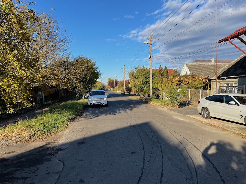
Szürte is situated about halfway between my grandmother's Csap and my grandfather's Szelmenc. My grandfather's mother was Barbara Meszaros; we don't know anything else about her, presumably from Szürte like the other Meszaros's. Except for getting out for the picture earlier above with the west side entrance sign, my other pictures of Szürte were taken through the window of the car. I'll leave detailing Szürte itself to my Meszaros cousins.
Szürte is near the north-south main highway connecting Uzhhorod with the border crossing at Csap/Zahony. As in Csap, the buildings in Szürte appear from the outside to be well maintained. But that gets left behind when heading to my grandfather's area. Getting there requires traveling west from Szürte, and very quickly you are in the middle of nowhere. In the two pictures below, especially the first one, the Carpathian mountains can be seen on the distant horizon.


Some potholes were so large that if Russia were to bomb the road it would be hard to tell. Speaking of Moscow, visible in the second photo are the remains of a collective farm, out in the middle of nowhere. Previously the tour guide had pointed out other such remnants, but they were close to main roads, with houses around. I knew that when the Soviet Union took control of Transcarpathia after World War II resistance had been violently suppressed. For example, Greek Catholic priests had been murdered. Still it was disturbing, and remains so, to see physical remnants of that time so close to locales on my family tree. I can even see what looks like a guard tower at a prison. It's reminders like that that have Ukrainians determined to recover their territory currently occupied by Russia. The Ukrainians concern is about more than just which accent or dictionary will prevail.
The name Szelmenc is not derived from Hungarian. Instead, according to the town history a Polish Count received a grant of land from the Pope in the 1300's. The Count's name as it was converted into Hungarian became Szelmenc. (In Hungarian, the combination sz is pronounced s; an s without a z is pronounced sh. The c at the end gets a ts sound). As often happened with other villages in Hungary, over time the Count's property was developed into two adjacent settlements: Little Szelmenc and Big Szelmenc, in Hungarian Kis- and Nagy-. My grandfather's birthplace was Nagy Szelmenc, which is Veľké Slemence in today's Slovakia. Big and Little have experienced a complicated national history, together before 1945 and separate since. Between the two World Wars what is now known as Transcarpathia was a part of, an eastern extension of Czechoslovakia. With Hitler's blessing in November 1938 Hungary annexed about 15% each of today's Slovakia and today's Transcarpathia (see for example Paul Lendvai's The Hungarians). All of the annexed territory, which included both Szelmenc's, had been part of Czechoslovakia since 1919. In March 1939 Hungary annexed the other 85% of today's Transcarpathia, despite the fact that the population of that 85% area had always been predominately non-Hungarian. After World War II Hungary's border was reset to where it had been established after World War I. The Soviet Union annexed Transcarpathia, creating a new eastern border for Czechoslovakia. The new border started out from Hungary extending north-northeast. Most towns fell easily east or west of the straight line, but at Szelmenc there was a problem. A slight dogleg was inserted into the straight line to put all of Little Szelmenc in the Soviet Union and all of Big Szelmenc in Czechoslovakia. Almost 20 years ago a border crossing for pedestrians only was established between the two Szelmenc's. I could not cross there with just my USA passport. I knew that, but had thought that I would be able to see across the border. Unfortunately buildings and other structures have grown to block the view. I was told that without crossing papers I could not pass the limits of Little Szelmenc, marked by the sign in the first photo below. The entire roof of the building on my right was in even worse shape than the corner. The building behind it, with the blue wall, was signed near the top, in English, Shopping Center. In the background of the second image you can see Ukraine, and then Slovak Republic (Slovakia). Someday I'll visit Slovakia, entering with my USA passport, and then find someone to escort me to the border on the other side.


So back to there being a difference between ethnicity and ancestry composition. The genealogical DNA test companies all provide percentage "ethnicity" estimates. For example, my autosomal DNA yields estimates of roughly 47% Irish and 45% Eastern Europe, with leftover percentages for Scotland, the Baltics and about 5% Mediterranean (the specific areas bounce around from the Adriatic to Spain to The Levant). Some companies properly avoid the term ethnicity. For example 23andMe substitutes a bland but more suitable "ancestry composition." Usually when a DNA match is selected you can also see the match's "ethnicity" estimate, the reasoning being that the common ancestor must be in one of the overlapping "components." For my matches where the overlapping component is Eastern Europe, those who specify known ancestors from there are more likely to specify Ukraine, Poland or Slovakia as their ancestral location rather than Hungary. For my grandfather I specify Hungary because, I say, "That is what it was when he left there." It's no more than ethnicity. My YDNA tells an interesting story about ancestry composition. But, aside from a link to this project page, I'll save discussing YDNA for a future post.


